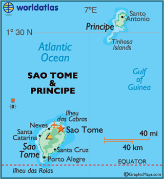
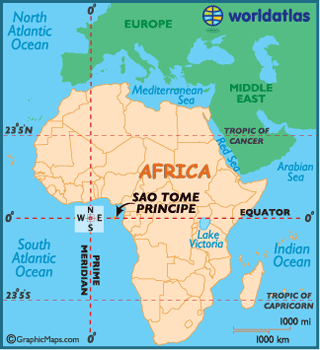
São Tomé and
Príncipe, officially the Democratic Republic of São Tomé and Príncipe, is a
Portuguese-speaking island nation in the
The islands of São Tomé and Príncipe were
uninhabited before the arrival of the Portuguese sometime around 1470. São Tomé
and Príncipe were taken over and administered by the Portuguese crown in 1522
and 1573, respectively. By the mid-17th century, it was primarily a transit
point for ships engaged in the slave trade between the West and continental
By the late 1950s, when other emerging
nations across the African Continent were demanding independence, a small group
of São Toméans had formed the Movement for the Liberation of São Tomé and
Príncipe, which eventually established its base in nearby Gabon. Picking up
momentum in the 1960s, events moved quickly after the overthrow of the Caetano
dictatorship in
In 1990, São Tomé became one of the first
African countries to embrace democratic reform, and changes to the constitution
— the legalization of opposition political parties — led to elections in 1991
that were nonviolent, free, and transparent.